|
|
 |
|
|
|
|


More separately issued maps:
[ Saddlebag maps | Mail coach era road maps | 19th century travel maps ]
[ Wall maps | Working marine charts ]
Other map pages: [ Locations | Map themes & related | Cartographers ]
![]()
There has always been a strong demand for maps showing on-going political, social or military events, either local or from around the world. These could include a new railroad, a war or border dispute, a new international situation, a social upheaval, or any other type of event for which there would be a demand for geographic information of the locale of that event. Most atlas maps were standard references that did not reflect specific events, so these often did not provide the information sought by those interested in those events. Magazines and newspapers would include relevant maps in their reporting, but these were usually crude, hastily made maps that did not satisfy many readers. Map publishers, therefore, issued special maps that focused on the locales involved, containing as accurate, contemporary and complete information as could be desired by those following the events in question. These maps were often issued in a folding format for ease of use and carrying, and because this offered the most protection for a separately issued map.
An exceedingly detailed sea chart of the Atlantic Ocean showing from Labrador to French Guyana in the Americas and from England to the Bight of Benin in Africa. Hundreds of ports are designated and some of the archipelagos have population statistics attached. Comparative miles for established sea routes are given. In the United States, not only are the navigable rivers shown, but also the network of canals that link the navigable waterways. A fine picture of the Atlantic world. $175
S. Percy Smith. "Map of the North Island, New Zealand." Wellington, N.Z.: New Zealand Survey, 1892. Separately issued, folding map: dissected into 16 sections and mounted on linen. 36 1/4 x 25 5/8. Wax engraving, printed in color. With manuscript line in pencil, showing course around island. Otherwise, excellent condition. Folding into original cloth cover.
A detailed and brightly colored map of the north island, New Zealand, issued by the New Zealand General Survey Office. Detail, based on the latest information, includes towns, rivers, lakes, roads, railroads (to 1887), and provincial boundaries. Very attractive as well as impressively informative. $275
"Submarine Cables of the World with the Principal Connecting Land Lines also Coaling, Docking, and Repairing Stations." Washington, D.C.: Hydrographic Office, Navy Department, 1896. Credits: "Division of Chart Construction, G.W. Littlehales, Assistant in Charge." and "Drawn by H.G. Brewer, Engraved by C.E. Burch, J.A. Waddey and R.E. Gray." Lithograph in color. 31 1/4 x 49 (full surface, folding into 18 sections. Linen backing. Excellent condition.
The U.S. Navy became involved in making sea charts as early as 1819, with Cheever Felch's survey of Cape Ann harbor. Most of the early charts were commissioned for locations where the navy was planning naval stations or depots. Most of the early printed charts were published privately rather than by the Navy. In 1830, an official Navy Depot of Charts and Instruments was established to purchase, store and produce charts for the Navy. This depot was led by such capable figures as Louis M. Goldsborough, Charles Wilkes, and Matthew Fontaine Maury. Naval surveyors worked independently but also in conjunction with the U.S. Coastal Survey.
Here is a Naval chart issued in 1896. It was intended to be used by Naval captains and so contained information that would be useful for navigation. Where the cables ran at this date is amazing to see. As a world map on a Mercator projection done prior to the Spanish-American War by two years, it illustrates the interest held for the entire World by the U.S. government. A fascinating picture of the soon to be presence of the United States in the West Indies and the Pacific. $650

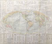
"The World upon a Globular Projection and with a Gazetteer of Information." Boston, Ottawa, New York: The Home Educator Company, 1907. 32 1/2 x 38.
Large folding map, the oval map (on a scale of 655 miles per inch) printed in color and surrounded by general information especially about the United States and Canada, plus tables, etc., comparing the finances, military strength, and the like, of the largest nation states of the time. Folded into original black boards (9 x 5 1/2). $150
J. Paul Goode. "The World: Political Wall Map Series." Sixth edition. Chicago & New York: Rand, McNally & Co., c. 1920. 45 x 64. Dissected into 28 sections and laid down on fabric folding into brown cloth covers. Three grommets at top. Some staining; else, good condition.
Prior to the First World War Rand McNally published a series of eighteen wall maps, half "Physical" and half "Political." The American Geographical Society's Geographical Review called them "the first modern geographical wall maps of American manufacture."
This world map is from the political series and shows the world after the war and the Versailles Conference. For example, there are Pacific Islands that had been Germany's but were now under a Japanese Mandate, while Palestine is shown as a British Mandate and Syria a French one.
John Paul Goode (1862-1932) was professor of geography at the University of Chicago. Interestingly, although he had labored to create a variation to what he termed "evil Mercator," this map is on Mercator projection. $650
More separately issued maps:
[ Saddlebag maps | Mail coach era road maps | 19th century travel maps ]
[ Wall maps | Working marine charts ]
Other map pages: [ Locations | Map themes & related | Cartographers ]
![]()
For further information, please contact:

![]()
106 E. Lancaster Avenue, Lower Level
Wayne, PA 19087 USA
610.808.6165
PhilaPrint@PhilaPrintShop.com ![]()
©The Philadelphia Print Shop July 15, 2021