|
|
|
|
|
|
|


Other map pages:
[ Locations | Map themes & related | Cartographers ]
Please contact us if you would like to see any map not already illustrated.
![]()
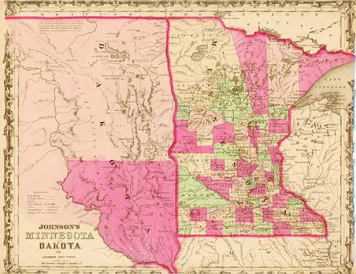
A graphic illustration of the border between the nascent development of the mid-west and the wilds of the western United States. This map shows Minnesota within a few years of statehood, and the eastern portion of what the Dakota Territory. Minnesota is shown broken into counties, and the southeast into survey quadrants. Towns, roads, and other signs of progressing settlement are indicated. To the west, the eastern part of the Dakota Territory (created the year before) is shown devoid of counties and railroads, and with only five towns large enough to be indicated. Little information was available of the northwestern part illustrated, with the Missouri, a few creeks and two forts the only details shown. A printed text at the top says, "The vast region of Prairies from Red River of the North and Mini Wakan I. to about the Gr. Bend of the Missouri R. is the great Hunting and Fighting Ground of Kdakotah, Odjibwe, Assiniboin, Arikara, Minitarree and other Nations." $150
"Johnson's Minnesota and Dakota." New York: Johnson & Ward, 1864. 12 5/8 x 15 1/2. Lithograph. Original hand color. Very good condition.
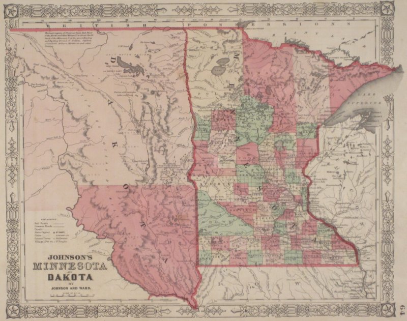
A later edition of the map above. $200

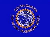
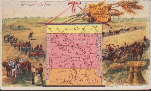
"South Dakota." New York: Arbuckle Bros. Coffee Company, 1889. Ca. 3 x 5. Chromolithograph by Donaldson Brothers. Very good condition.
From a delightful series of maps issued by the Arbuckle Bros. Coffee Company. This firm was founded by John and Charles Arbuckle of Pittsburgh, PA. They developed a machine to weigh, fill, seal and label coffee in paper packages, which allowed them to become the largest importer and seller of coffee in the world. Their most famous promotional program involved the issuing of several series of small, colorful trading cards, one of which was included in every package of Arbuckle's Coffee. These series included cards with sports, food, historic scenes, and--one of the most popular--maps. The latter cards included not only a map, but also small illustrations "which portrays the peculiarities of the industry, scenery, etc." of the region depicted. These cards are a delight, containing informative maps as well as wonderful scenes of the area mapped. $60
Other map pages: [ Locations | Map themes & related | Cartographers ]


![]()
For further information, please contact:

![]()
106 E. Lancaster Avenue, Lower Level
Wayne, PA 19087 USA
610.808.6165
PhilaPrint@PhilaPrintShop.com ![]()
©The Philadelphia Print Shop Last updated July 15, 2021