 |
||
![]()

![]()
With the opening of the Erie Canal in 1825, the United States entered a period of rapid building, first of an extensive canal network and later an even larger railroad network. This led to a demand for works giving practical information on this growing transportation nexus. Henry S. Tanner, an important American map engraver and publisher, met this demand in 1834 with his A Brief Description of the Canals and Rail Roads of the United States. With the continued growth of canals and rails, Tanner issued an expanded, no longer "Brief," work on the same topic in 1840. In 1840 canals were still being planned and constructed, but the rapid improvements in the technology of tracks and steam meant the momentum was clearly in favor of the railroads. By 1840 there were 2,816 miles of railroads in the United States compared with 1,331 miles in England.
The text of this book is filled with the popular phrases lauding "internal improvements" that were promoted by the U.S. Government and financed through the sale of public lands and training of engineers in the military academies. A general description of the nation is followed by chapters on each state as well as Canada. A glossary of terms and index follows. This book was designed to interest the foreign investor as well as the domestic traveler or merchant. This work came out in a number of versions, of which this is the best, bound into a slightly larger format and including two extra maps, besides the standard map of the United States folded into the front.
Frontis map. "Map of the Canals & Railroads of the United States. Reduced from the large Map of the U.S. by H. S. Tanner." Engraving by J. Knight. 17 1/4 x 23. Insets of "South Part of Florida" and profiles of Chesapeake & Delaware Canal, Dismal Swamp Canal, Welland Canal, and Lehigh Navigation." State boundaries are shown with Missouri and Arkansas as the newest and westernmost states. Actual and proposed canals and railroads are outlined. Facing page 80. "A New Map of New York." Insets: "Profile of the Erie Canal" and steamboat routes. 10 1/2 x 12. Facing page 144. "A New Map of Pennsylvania with its Canals, Rail=Roads & Distances from Place to Place along the Stage Routes." Engraving by W. Brose, Philadelphia. Insets: "Profile of the Pennsylvania Canal and Columbia Railroad" and steamboat routes. 10 1/2 x 12 1/2. $1,250
Henry S. Tanner. A Description of the Canals and Rail Roads of the United States, comprehending Notices of all the Works of Internal Improvement Throughout the Several States. New York: Tanner & Disturnell, 1840. Octavo. Frontispiece map, [i]-viii, 9-273. Plus two folding diagrams. Original embossed blue-green cloth with gold-stamped spine title. With some light water staining. With some water stains and foxing in interior, but still overall good. Ref.: Sabin: 94316; Howes: T-26.
Another version of Tanner's Description of the Canals and Rail Roads of the United States issued in 1840. This version is on slightly smaller paper. It includes two profile diagrams of major canals and railroads, but lacks the two folding maps that appeared in the larger version (cf. above). $950
Traugott Bromme. Hand- und Reisebuch fur Auswanderer nach den Vereinigten Staaten von Nord-Amerika, Texas und Californien, Ober- und Unter-Canada, Neu-Braunschweig, Neu-Schottland, Santo Thomas in Guatemala, der Mosquitofuste und Brasilien. Bamberg: C. C. Buchner, 1851. 8vo. Original grey boards with gold-stamped cloth spine title. Boards worn, interior water-stained to p.66, scattered stains and foxing throughout. Fair, but binding intact. Cf. Howe: B800; Sabin: 8211.
With accompanying map: Joseph Edmund Woerl. "Die Vereinigten Staaten Von Nord-America." Germany, ca. 1836. Folding map, dissected into eighteen sections and mounted on linen. 18 1/4 x 25 1/2. Lithograph by B. Herder. Light, original outline color. Very good condition.
An unlisted edition of Traugott Bromme's influential 'Hand and Travel Book For Emigrants.' Bromme was one of the most prolific German Travel writers from the 1830s to 1850s; between about 1835 and 1865, he issued a number of travel guides to America, many accompanied by maps. As Howe says, "Based on actual travels this constituted the most extensive source of information for emigration-minded Europeans." The guides were aimed at the large number of Germans interested in emigrating to America and they had a wide circulation and influence. This edition was issued with an accompanying map of the United States; the title page says it was a map by Tanner, but as indicated in Sabin and Rumsey, it was actually a map by Joseph Woerl (also Wörl). Rumsey has high marks for the map, calling it a beautifully engraved map of the US. The map includes interesting and impressive detail in what is today the western half of the United States, apparently based on Brué's 1833 map of North America and his 1834 map of Mexico. Indians tribes, rivers, and some roads are indicated, and Woerl shows the Rocky Mountain ridge, which though not totally accurate, does give a good idea of its course and extent. To the west, between this ridge and the Pacific coastal lands, very little information is given, with a label indicating that this was "Oede Sand Wüste." Woerl does include the geographic error of the double Great Salt Lake, but he doesn't include the usual companion error of rivers running from these lakes to the Pacific. Texas is shown with interesting early information. Arkansas (statehood 1836) is shown, though it is labeled as "Arkansas Terr," and the remnant of the Arkansas Territory, essentially present-day Oklahoma, is also entitled Arkansas. Good detail is also given along the Rio Colorado, especially in the largely mythical headwaters west of the Rocky Mountains. Two Salt Lakes are prominently shown, along with the remnants of several mythical western rivers. The Puget Sound, Columbia and Frasier River treatment is also excellent. Shows many Indian Tribes, Forts, Roads, Lakes, Rivers, Mountains and other places of interest. Massive Missouri Territory dominates the mid-Continent. This version of the map appears to be identical to the 1838 edition (which is dated), though with different coloring, and it is identical to the version accompanying the 1848 Bromme traveler's guide (Rumsey 3048) $1,950

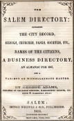
George Adams. The Salem [Massachusetts] Directory: Containing the City Record, Schools, Churches, Banks, Societies, etc., Names of the Citizens, a Business Directory, an Almanac for 1855, and a Variety of Miscellaneous Matter. Salem: Henry Whipple & Son, 1855. Octodecimo. 6 x 4. Boards loose, but not fully detached. Folding map of Salem by G. G. Smith. 247 pages, including a directory of residents, one of businesses, and a section of government, schools, churches, and the like, plus 30 pages of advertisements, some nicely illustrated. Each month has a two page entry, one for personal memoranda and one giving the time of each day's sunrise, sunset, and high tides, plus the phases of the moon and a schedule of Massachusetts local court dates.
Boston engraver George G. Smith had worked with William B. Annin from around 1820 to 1831. Annin & Smith did business with Josiah Loring, engraving the gores for some of his globes.
Although Nathaniel Hawthorne had left Salem, and Alexander Graham Bell had yet to arrive, one interesting 1855 resident listed is Charles L[enox] Remond (1810-1873), 9 Dean Street, African-American orator, activist, abolitionist, conductor on the Underground Railroad, and recruiter during the Civil War for the United States Colored Troops, notably the 54th Massachusetts. $85
Casimir Bohn. Bohn's Hand-Book of Washington. Illustrated with Engravings of the Public Buildings and the Government Statuary. Fourth Edition -Revised and Enlarged. Washington, 1856. 12mo. 132pp. Page ends gilt. 20 lithographed views. Folding map in back. Original printed pictorial boards; taped spine.
Bohn's Handbook of Washington went through many editions, so it must have been a successful publication in the 1850s. The title page calls the illustrations "engravings" but they are lithographs and quite beautifully done. Included is a fine "Map of the City of Washington in the District of Columbia . . .." Also: "Plan of Georgetown." Inset shows "East Front of the Capitol with the Extensions." Lithographed by L. Sachse & Co. in Baltimore. 12 1/2 x 16 (full sheet). $650
Morrison's Stranger's Guide for Washington City. Illustrated with Wood and Steel Engravings. 12 mo. Washington: W.H. & O.H. Morrison, 1873. [5]-74 pp. 9th Edition according to the preface.
This guide book to Washington contains 31 views and floor plans of buildings and monuments, many folding out, plus a large folding map which is lithographed and measures 15 1/2 x 20. $450
De B. Randolph Keim. Keim's Illustrated Hand-Book. Washington and Its Environs: A Descriptive and Historical Hand-Book of the Capital of the United States of America. Sixteenth Edition. Washington: For the Compiler, 1882. 18mo. Two folding maps, diagrams of public buildings and many wood engravings. Original boards and spine. Complete, with minor staining.
Born in Reading, PA, De Benneville Randolph Keim (1841-1914), covered the Civil War for the New York Herald, during which he became friendly with Ulysses S. Grant, who, while President, sent him to inspect consulates in Asia, Africa and South America. Besides sightseeing guides, his writings included Sheridan's Troopers on the Borders: A Winter Campaign on the Plains (1870) and research on Keim family genealogy.
This guide includes historical facts on the capital, indicates the operations of railroads, steamers and streetcars, provides detailed descriptions both of public squares and of rooms in the Capitol, Executive Mansion, Smithsonian, etc., and even specifies that cabinet secretaries' wives would usually receive callers on Wednesdays! Keim intended that the book would "prove not only an invaluable companion on the spot, but an ever-welcome and entertaining friend for future perusal and reference at the home fireside." $160
![]()
For further information, please contact:

![]()
106 E. Lancaster Avenue, Lower Level
Wayne, PA 19087 USA
610.808.6165
PhilaPrint@PhilaPrintShop.com ![]()
©The Philadelphia Print Shop Last updated July 16, 2021