
[ A Nation Divided | Main Index | Civil War Reference Books ]
Civil War:
Maps from illustrated newspapers

Besides their images of battles, views of fortifications, and portraits of participants in the Civil War, the illustrated newspapers of the day included many interesting maps related to the conflict. Many readers had little knowledge of the geography of the south and west, where most of the actions of the war took place, so the newspapers often put in maps related to the stories of the day.
Note on condition: The paper used for the illustrated papers was not of top quality and in general these prints were not treated with great care. Thus most of these prints have some discoloration, minor edge tears and occasional light stains or spots. The prints listed below are in "good" condition, with any significant flaws noted. We would be happy to provide a more detailed description of any particular prints upon request.
- "Map Showing the Forts, Islands, Etc., of the Harbor of Charleston, South Carolina," and "Fort Johnson, Opposite Fort Sumter, Harbor of Charleston, South Carolina." From Harper's Weekly. New York, January 19, 1861. 6 5/8 x 6 7/8 and 6 x 9 1/4, respectively. $35
- "The Harbor of Pensacola, Florida, Showing the Forts, Navy Yard, Etc." From Harper's Weekly. New York, February 9, 1861. 6 7/8 x 9 1/8. A map showing the fortifications at Pensacola. $25
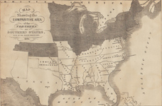
- "Map Showing the Comparative Area of the Northern and Southern States, East of the Rocky Mountains. 1861." From Harper's Weekly. New York, February 23, 1861. 9 1/8 x 13 3/4. Though it wasn't until May that all eleven southern states joined with the Confederacy, this map shows the what would become the confederacy in comparison to the Union states east of the Rocky Mountains. Many of the Indian tribes in the Indian Territory, though it was never part of the Confederacy, did support the Southern cause. NA
 Go to text on Confederacy in April 1861
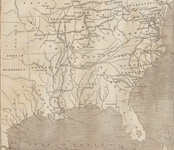
- "Map of the Coast Line From the Mouths of the Mississippi to Pensacola." From Harper's Weekly. New York: March 30, 1861. 9 x 13 3/4. The text explains that the map "will shed light on the discussions which are taking place..with regard to the effects of the establishment of a Southern Confederacy upon trade." $25
- "Map of Charleston Harbor, Showing Fort Sumter and the Confederate Batteries." From Harper's Weekly. New York: April 27, 1861. Full page, 9 1/4 x 14. NA
- "Map of Part of Maryland and Virginia, Showing the Probable Theatre of the War." From Harper's Weekly. New York: May 4, 1861. 9 1/8 x 13 7/8. $25
- "Map Showing the Line of the Blockade, and the Strategic Routes in the Interior." From Harper's Weekly. New York, May 25, 1861. 9 1/4 x 10 1/2. $30
- "Pictorial Map of the Seat of War, Showing Parts of the States of Maryland, Delaware, Virginia, and North Carolina, and also the Coast Line From Cape Henry to Fort Pickens, with the United States Blockading Fleet." From Harper's Weekly. New York, June 8, 1861. 14 x 20 1/2.
A remarkable bird's eye view of eastern part of the country from the head of the Chesapeake all the way to Florida. Major towns and cities, railroads and the blockading fleet are shown. This map would have provided readers of Harper's with a great visual reference for the various events of the early days of the war. $150
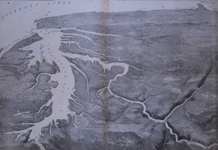
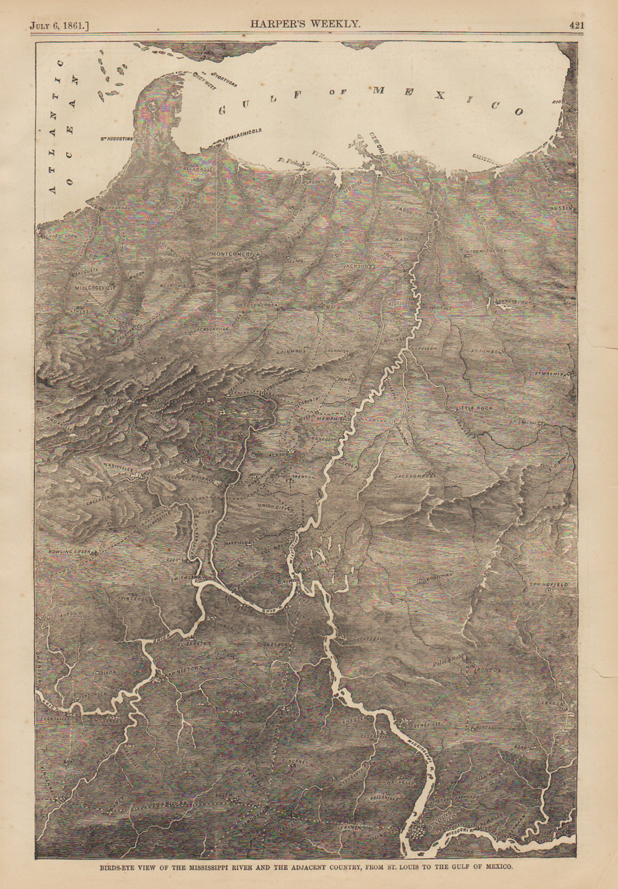
- "Bird's-Eye View of the Mississippi River and the Adjacent Country, From St. Louis to the Gulf of Mexico." From Harper's Weekly. New York, July 6, 1861. 9 1/8 x 13 3/4. $40
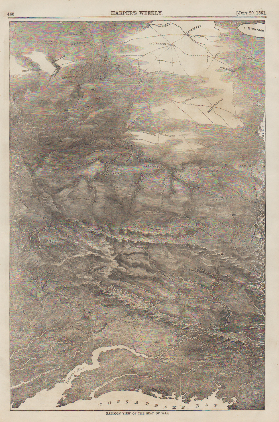
- "Balloon View of the Seat of War." From Harper's Weekly. New York, July 20, 1861. 9 x 13 3/4. $40
- "Map of the Seat of War in Virginia." From Harper's Weekly. New York, August 10, 1861. 9 1/4 x 13 7/8. Phila. $50
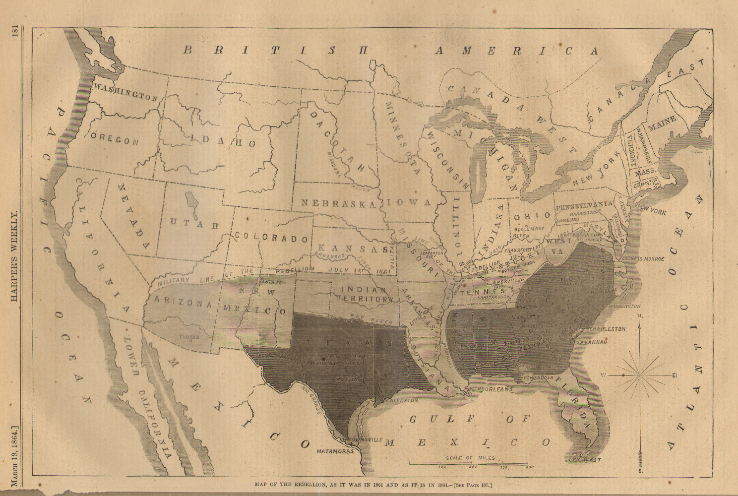
- "Map of the Rebellion, as it was in 1861 and as it is in 1864." From Harper's Weekly. New York, March 19, 1864. 9 1/8 x 13 3/4. $45
 Go to main subject index


For further information, please contact:


106 E. Lancaster Avenue, Lower Level
Wayne, PA 19087 USA
610.808.6165
PhilaPrint@PhilaPrintShop.com 
©The Philadelphia Print Shop July 14, 202


